Death Valley
|
 |
|
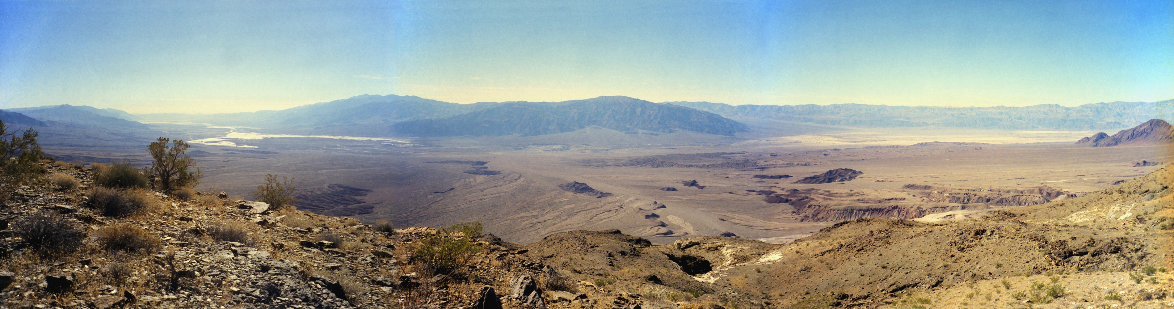
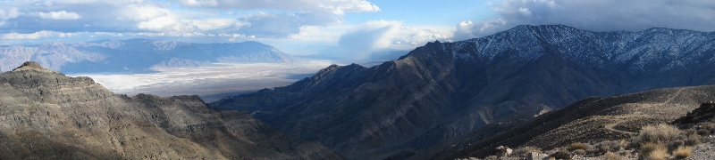
Classic Dante's View shot. Feb 2010
|
|
 |
|
Lake Manly at dusk. Feb 2010
|
|
 |
|
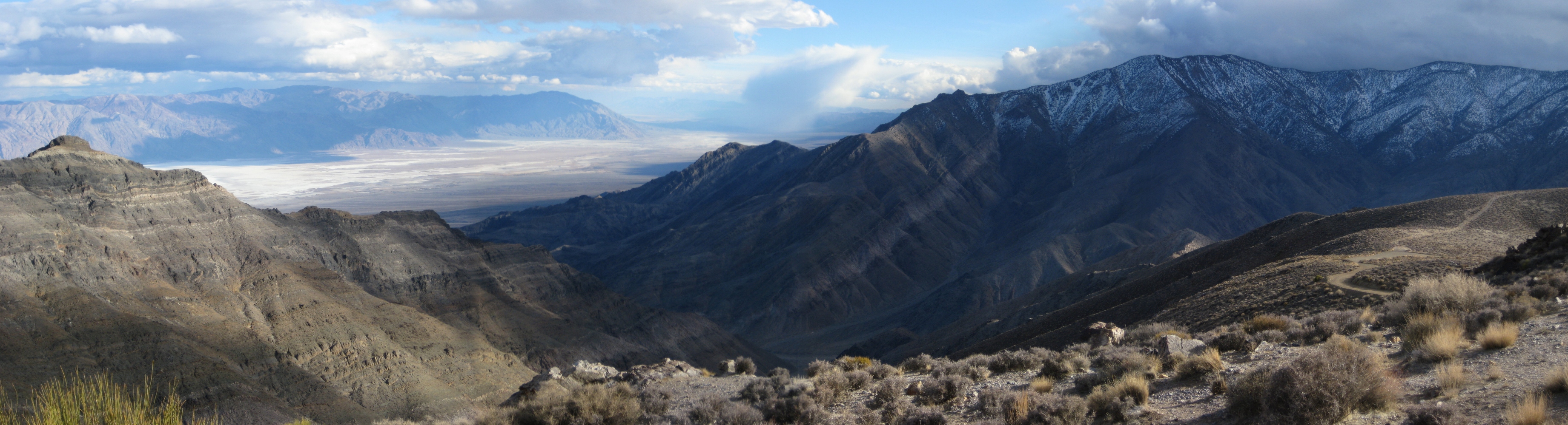
Mt. Perry and the salt flats, sun setting behind Telescope Peak. Feb 2010
|
|
 |
|
View north and east from Wildrose Peak, January 1996. Inyo mountains behind Bald Peak on the left, Badwater and Funeral Peak on the right.
|
|
 |
|
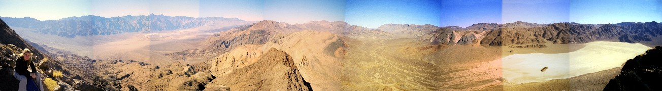
View of southern Death Valley from Jubilee Peak, February 2007
|
|
 |
|
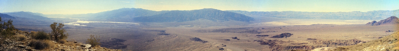
Looking NE from Aguereberry Point, February 2008
|
|
 |
|
Looking SE from Aguereberry Point, February 2008
|
|
 |
|
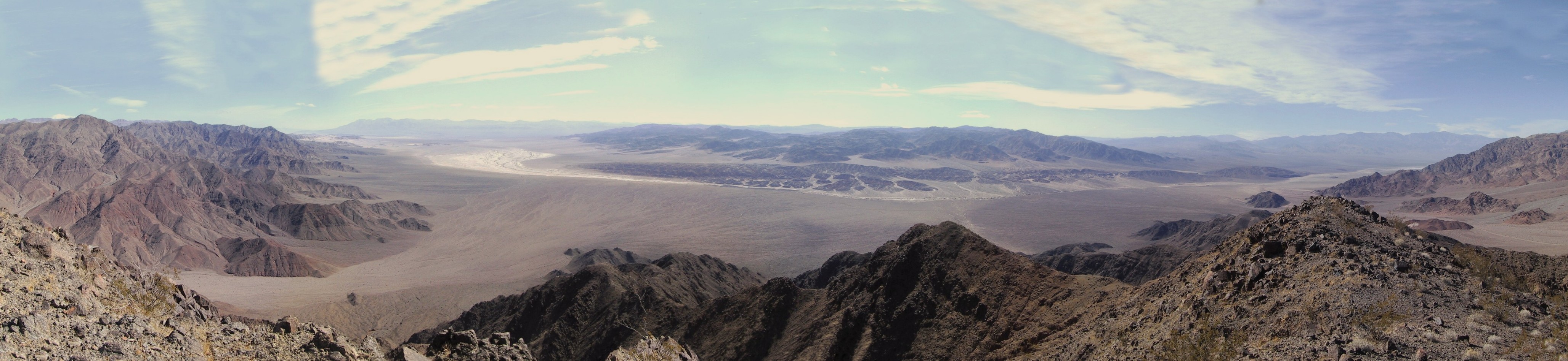
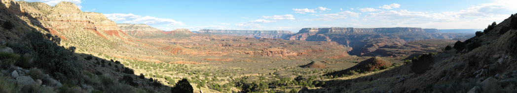
Saline (left) and Racetrack (on the right) Valleys from part way up Ubehebe Peak, December 1999. One of my favorite Death Valley views.
|
|
 |
|
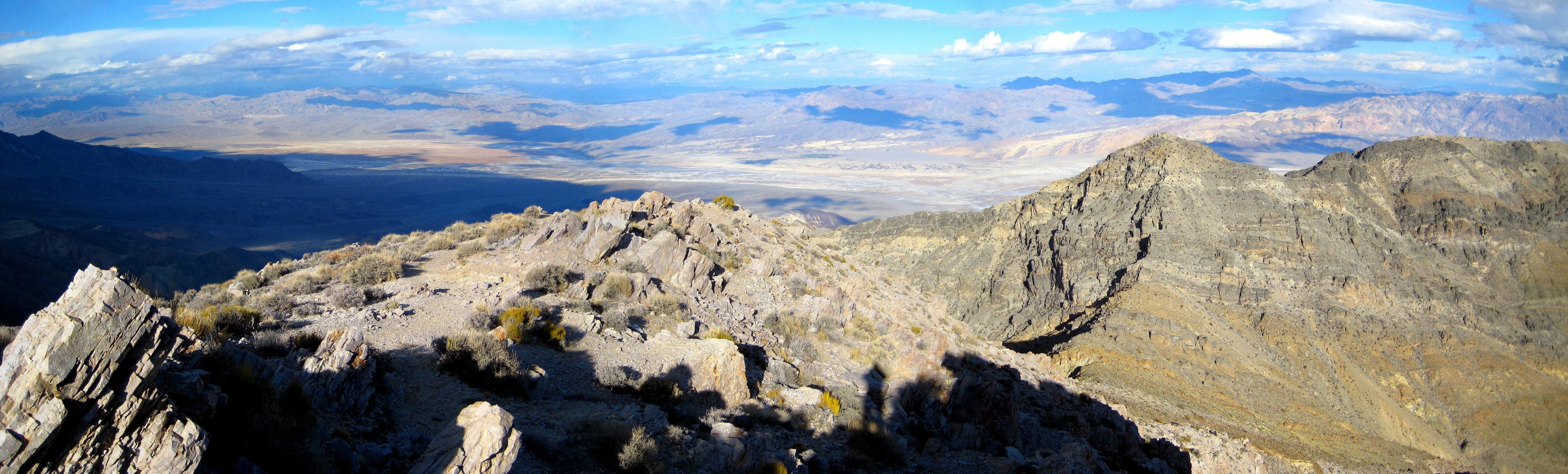
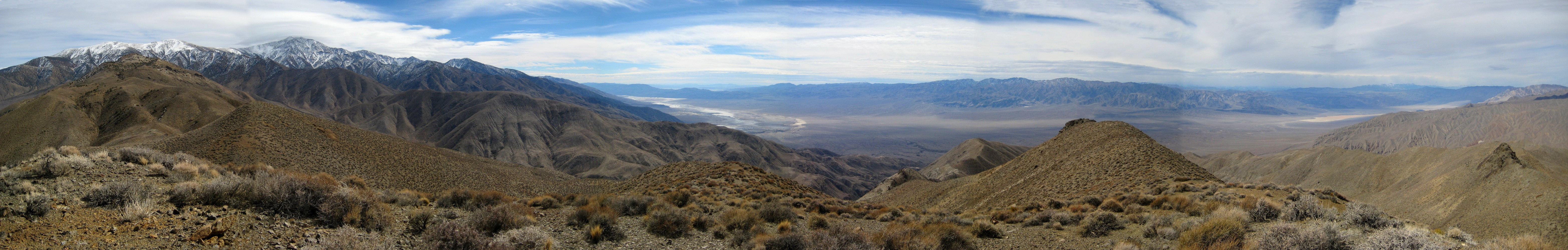
Telescope Peak and the Panamint Valley from Tuber Peak, with a storm approaching over the Sierra. Feb. 2008
|
|
 |
|
360 degree view from the summit of Corkscrew Peak, January 1998. DV Buttes down at the middle bottom. Striped Thimble Peak at the far right.
|
|
 |
|
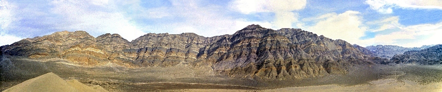
Looking west from the Keane Wonder mine, Jan. 1999. This area was officially closed in fall 2008, how sad.
|
|
 |
|
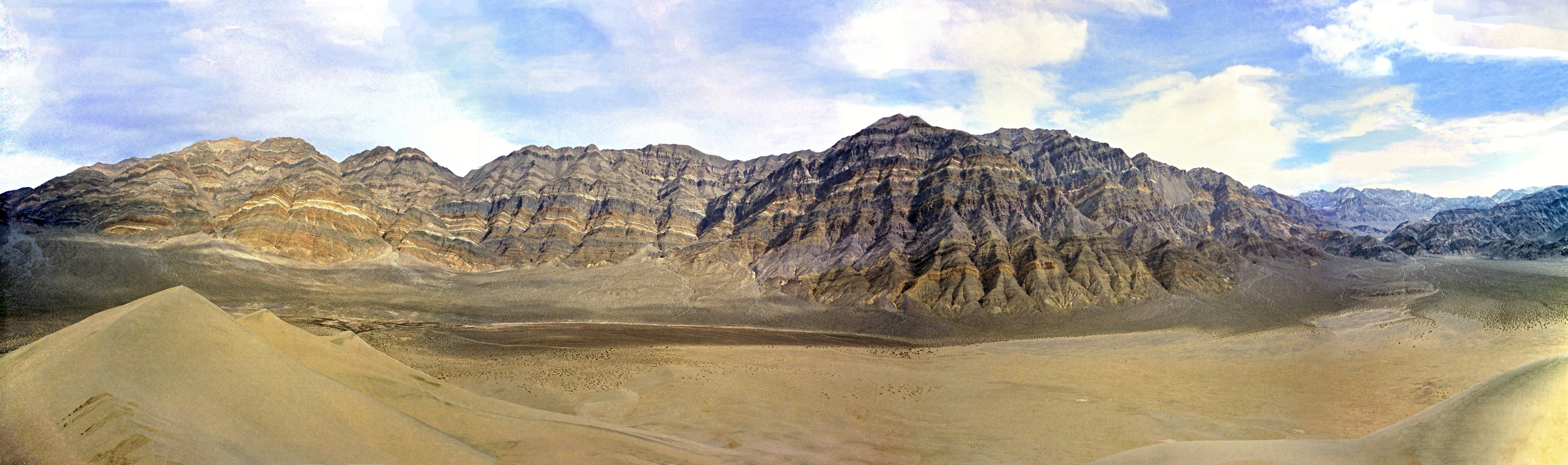
Last Chance Range from on top of the Eureka Dunes, Jan. 1998. Steele Pass into the Saline Valley is at the far right.
|
|
 |
|
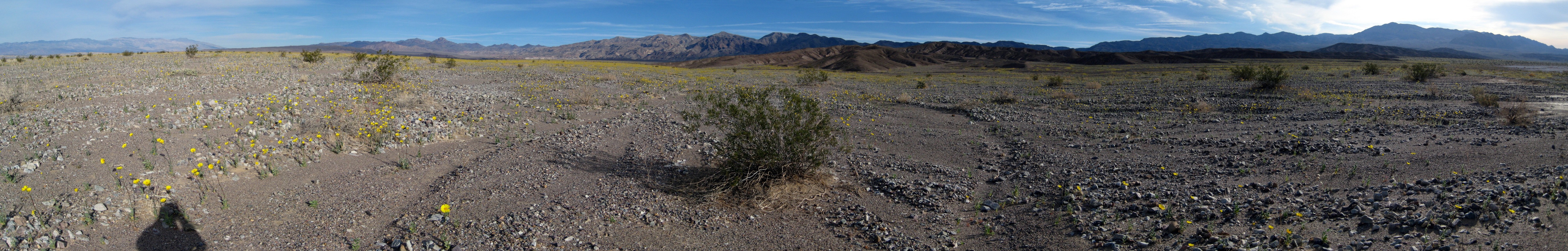
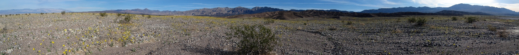
Desert Gold in bloom north of Furnace Creek, Feb. 2008
|
|
|
More Death Valley panos
|
|
|
 |
|
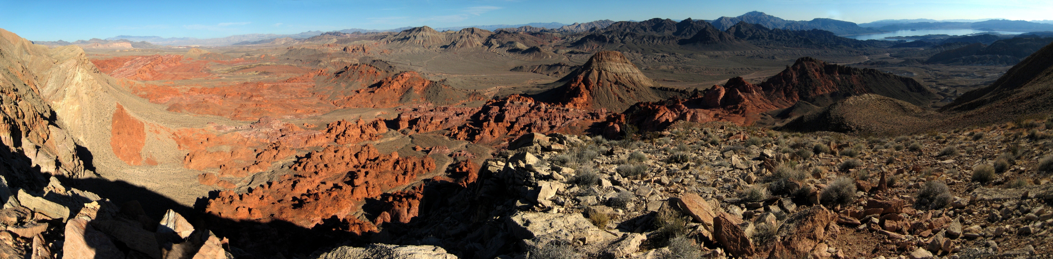
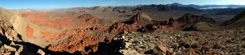
The Bowl of Fire and Lake Mead, January 2008
|
|
 |
|
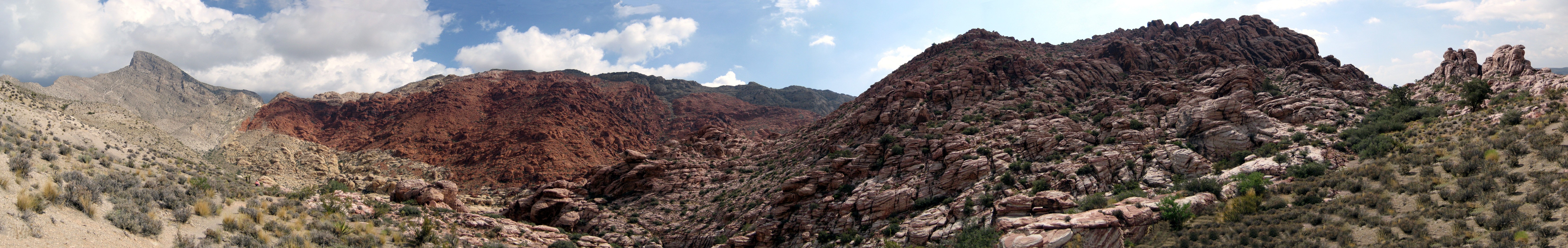
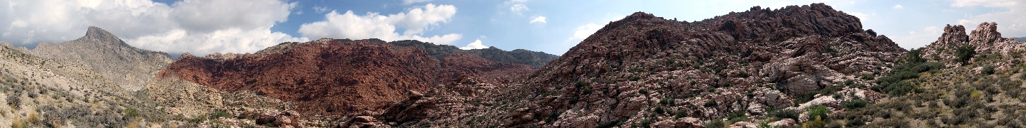
Calico Basin, west of Las Vegas, July 2008. Turtlehead Peak is on the left; 360 degrees.
|
|
 |
|
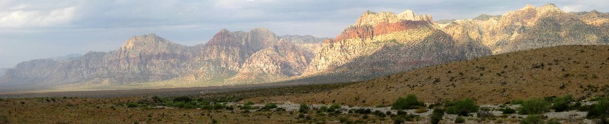
The escarpment at Red Rocks, west of Las Vegas, July 2008
|
|
Grand Canyon
|
 |
|
Sunrise near Monument Point, June 2009
|
|
 |
|
Climbing out the Thunder River trail late in the day, June 2009
|
|
 |
|
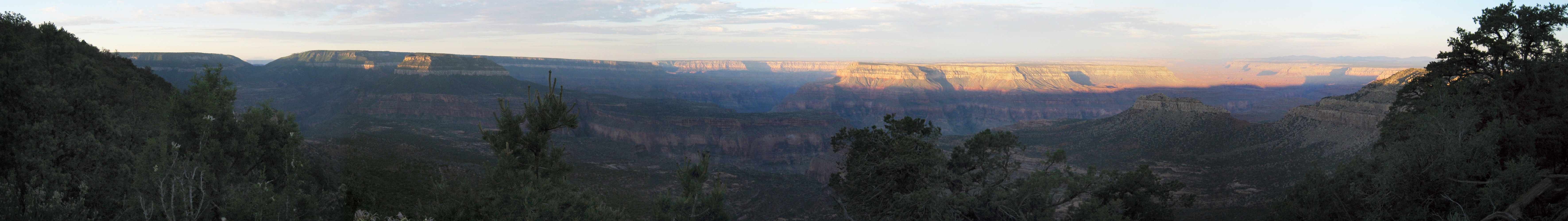
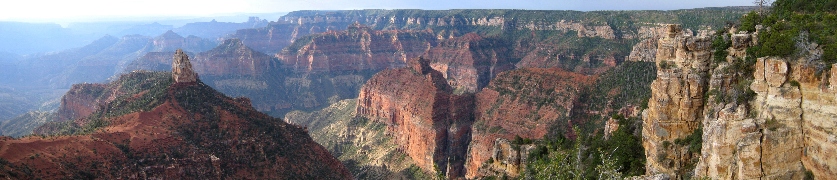
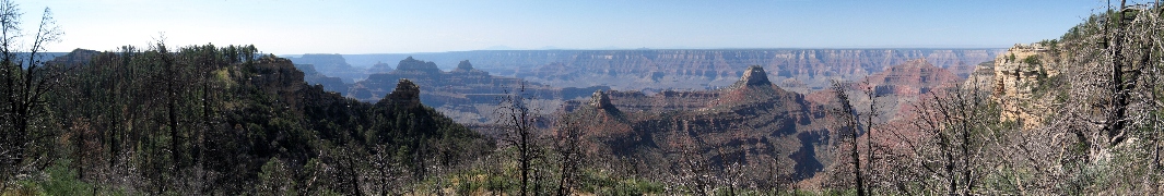
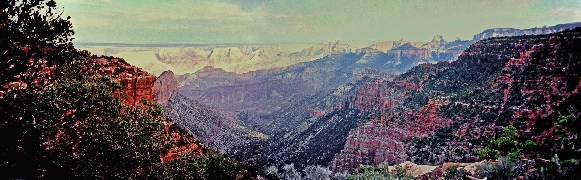
Mt. Hayden and Nankoweap Canyon, July 2007
|
|
 |
|
Sunrise at Fence Point, June 2009
|
|
 |
|
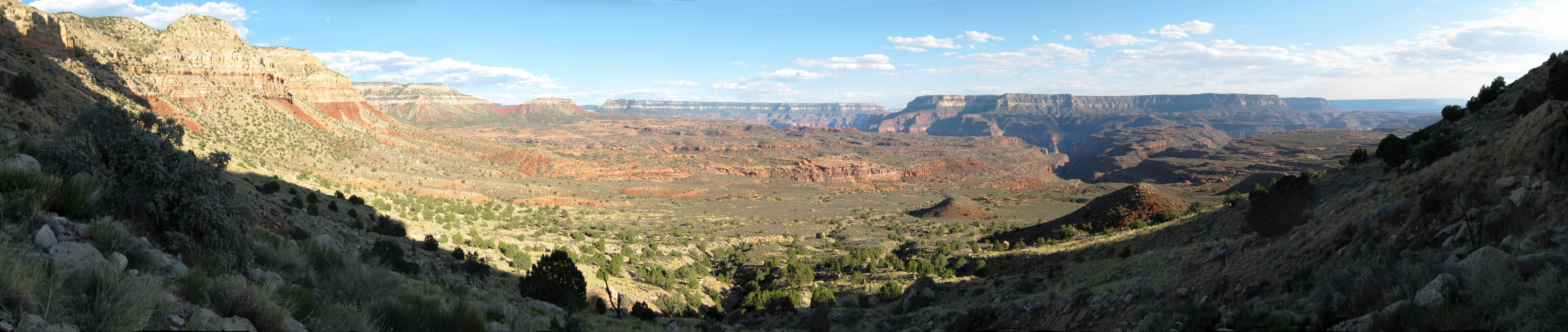
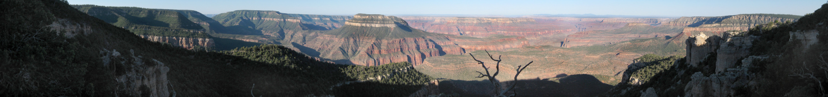
View on the Esplanade, June 2009
|
|
 |
|
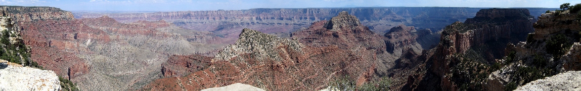
Widforss Point, July 2007
|
|
 |
|
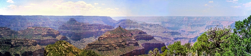
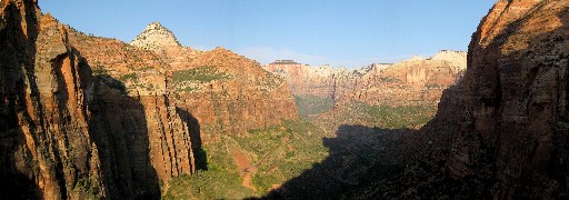
Bright Angel Canyon and The Transcept from Bright Angel Point, July 2007
|
|
 |
|
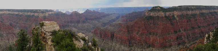
Cape Royal, July 2007
|
|
 |
|
View from the end of Rainbow Plateau, July 1997
|
|
 |
|
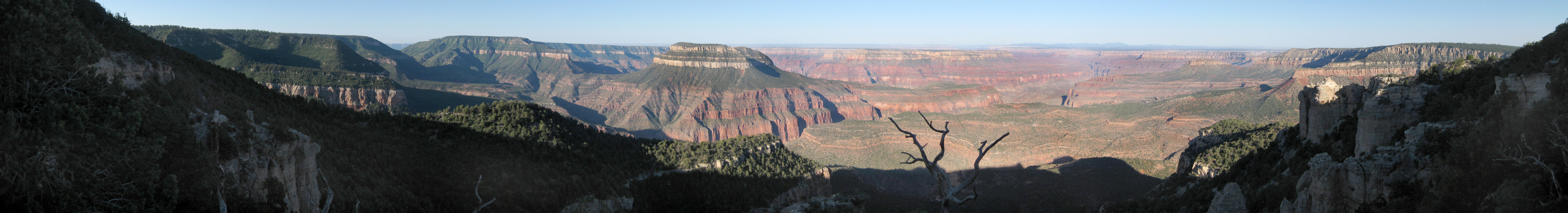
Sunset in Nankoweap Canyon; Marion Point is on the left. July 1997
|
|
|
|
 |
|
South Coyote Buttes, July 2011
|
|
 |
|
Behind Crazy Quilt Mesa, June 2011
|
|
 |
|
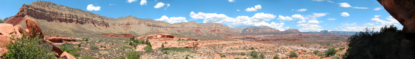
Yellow Rock, GSENM, June 2011
|
|
 |
|
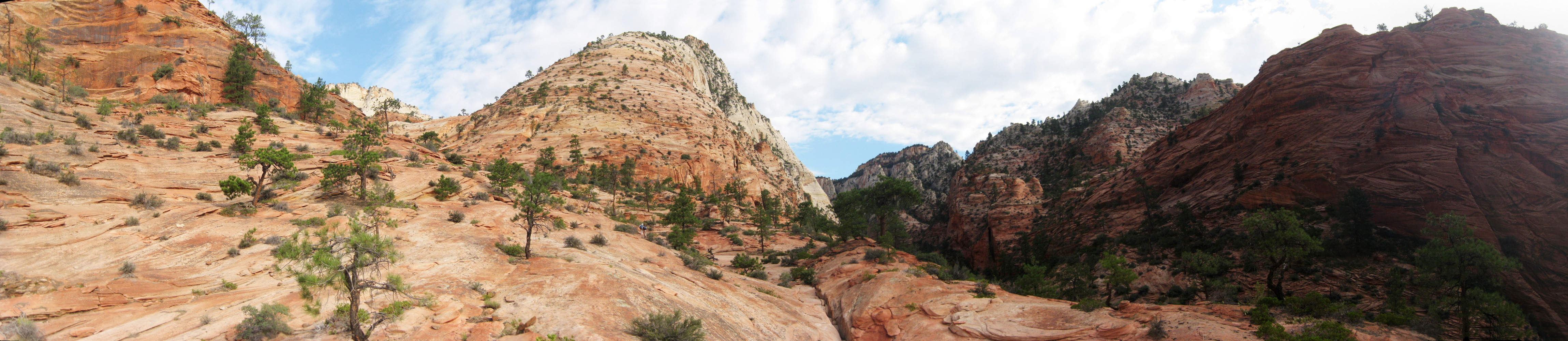
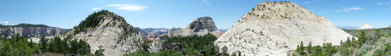
Northgate Peaks, Zion, July 2010
|
|
 |
|
The Guardian Angels and beyond, from East Northgate Peak, Zion, July 2010
|
|
 |
|
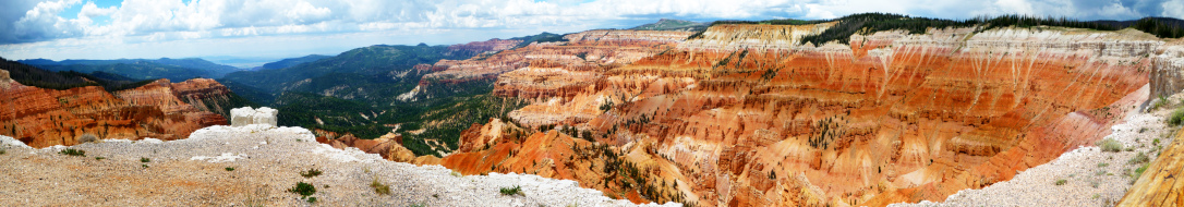
Cedar Breaks, July 2010
|
|
 |
|
Deertrap Mountain, Zion, July 2010
|
|
 |
|
Loosee Canyon, Red Canyon, July 2010
|
|
 |
|
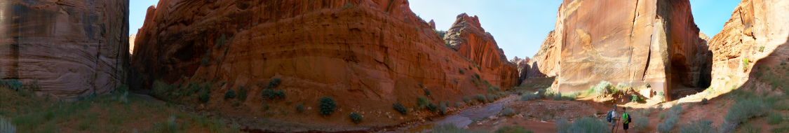
Confluence of Wire Pass and Buckskin Gulch, GSENM, July 2010
|
|
 |
|
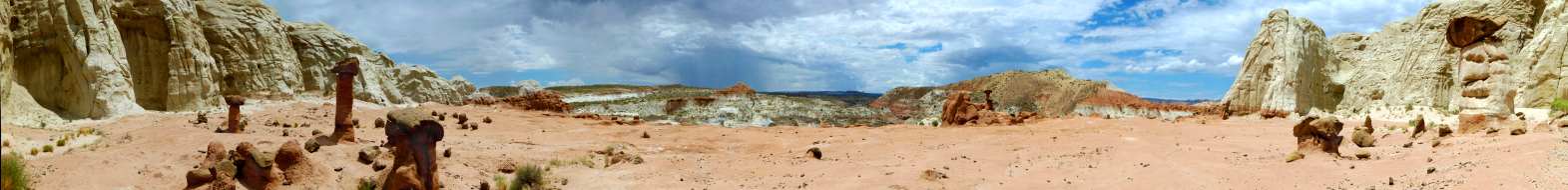
Mushroom Rocks, GSENM, July 2010
|
|
 |
|
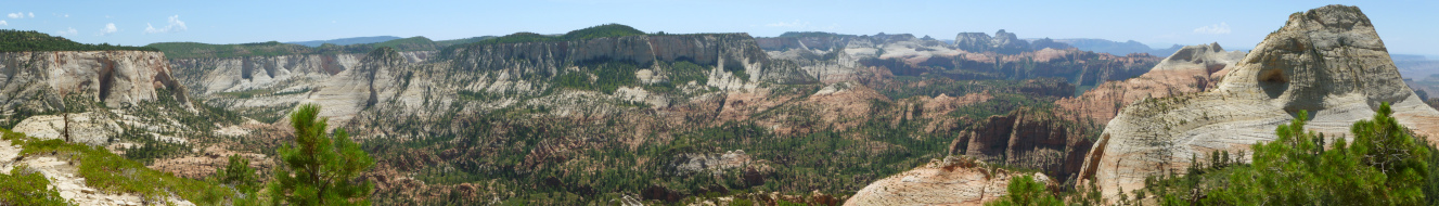
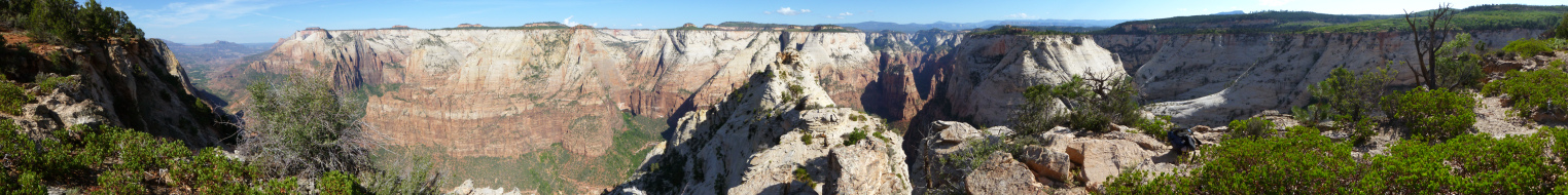
View over East Zion from near the East Temple, Zion, July 2009
|
|
 |
|
Above Pine Creek headed toward Twin Brothers, Zion, July 2009
|
|
 |
|
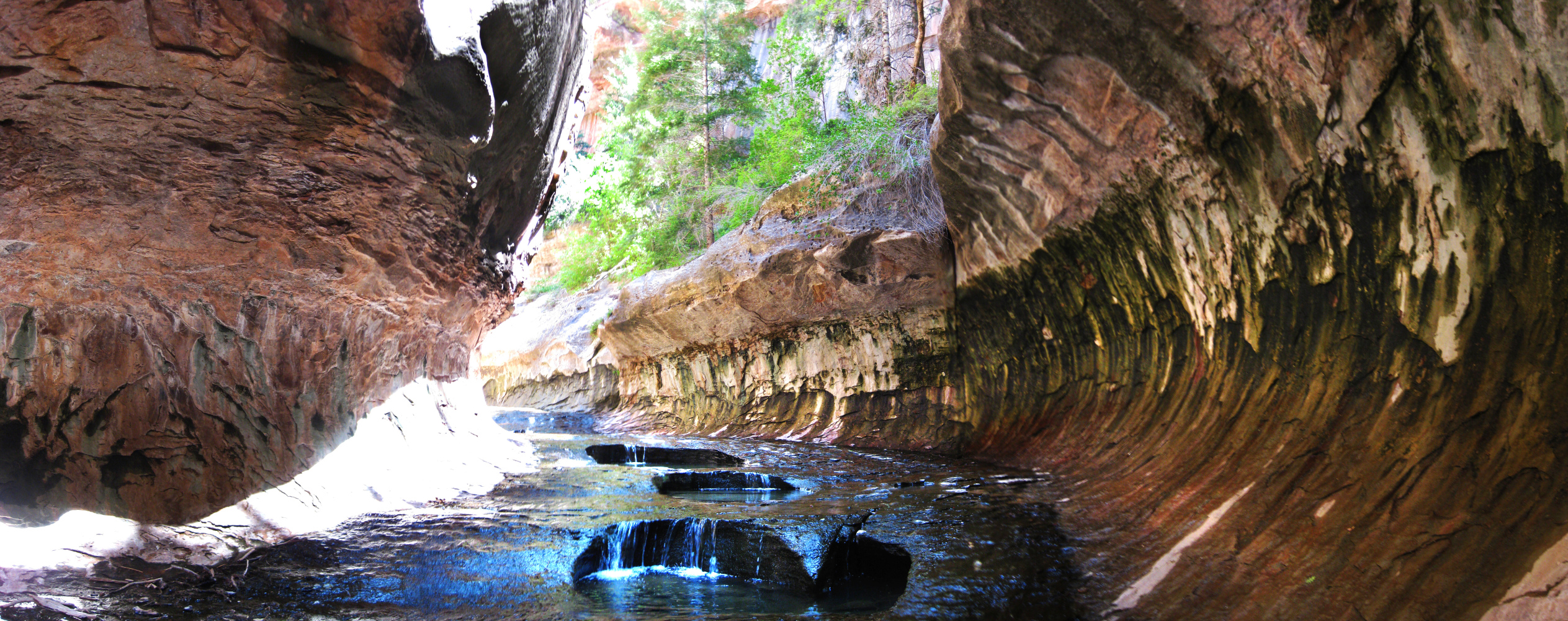
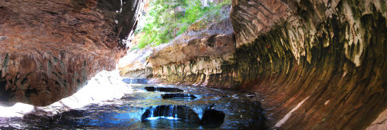
Last pools in the Subway, Zion, July 2009
|
|
 |
|
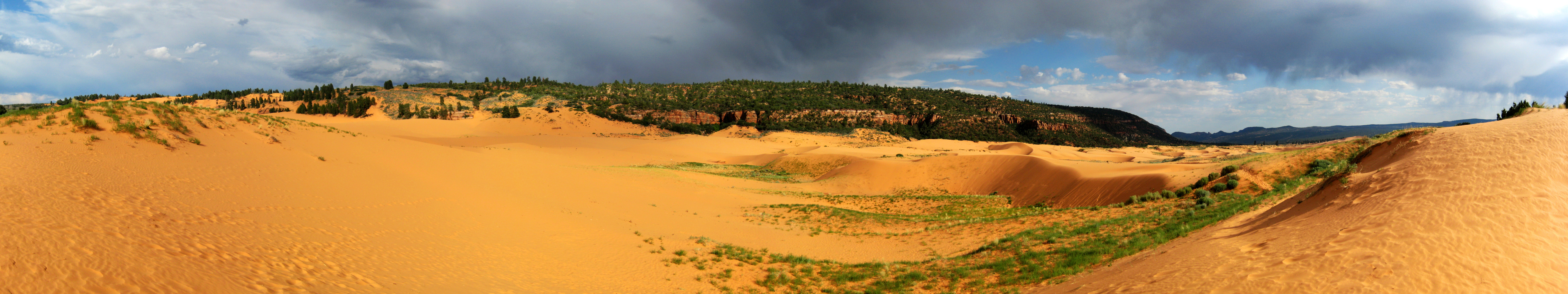
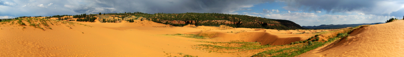
Coral Pink Sand Dunes with rain approaching, July 2009
|
|
 |
|
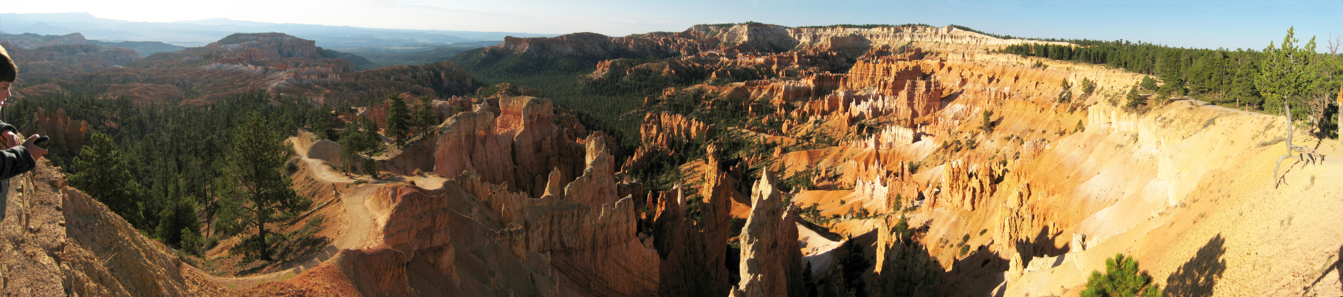
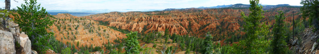
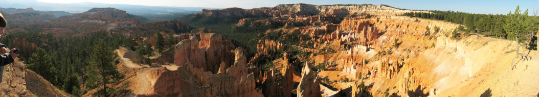
Morning at Bryce Canyon, July 2009
|
|
 |
|
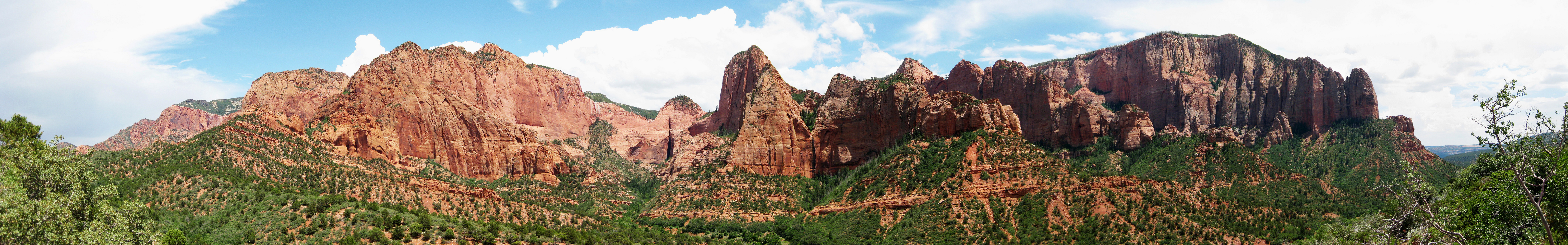
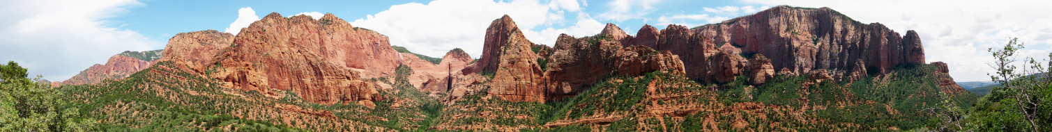
The escarpment at Kolob Terrace, Zion, July 2009
|
|
 |
|
Twin Brothers, Zion, July 2009
|
|
 |
|
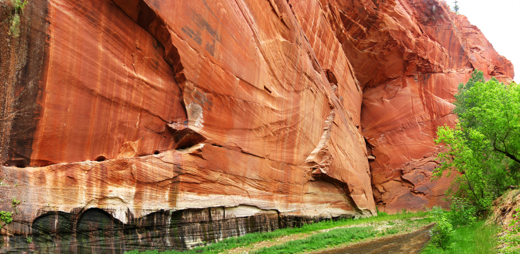
Navajo sandstone, Parunuweap, June 2009
|
|
 |
|
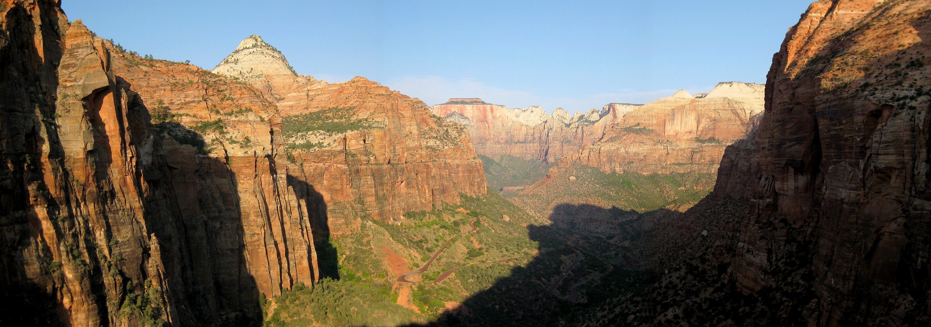
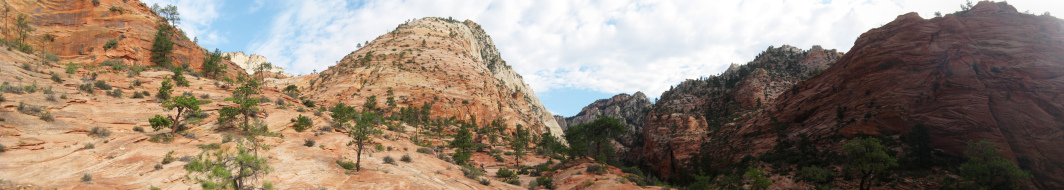
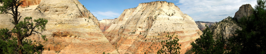
Canyon Overlook, Zion, July 2008
|
|
 |
|
Povertry Trail into Parunuweap, June 2009
|
|
 |
|
Observation Point, Zion, July 2008
|
|
 |
|
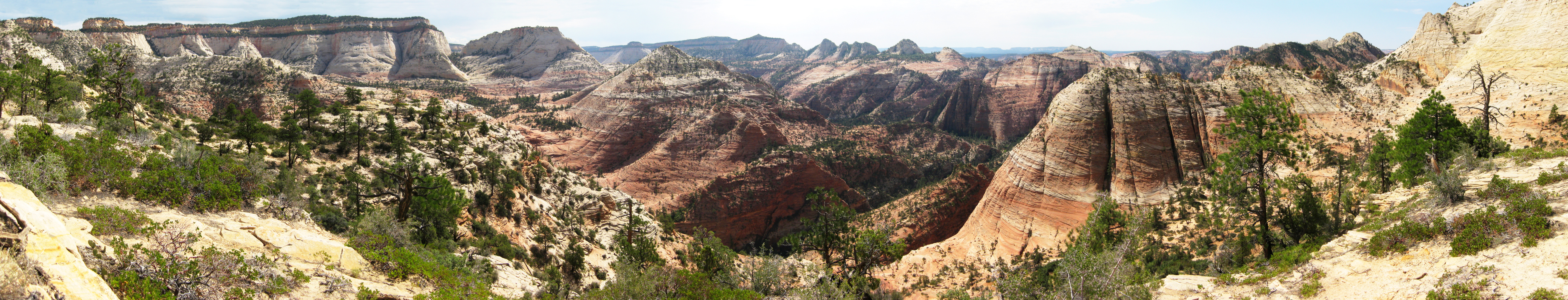
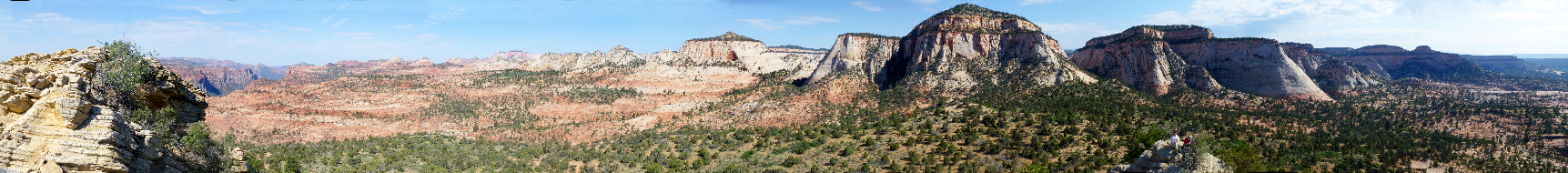
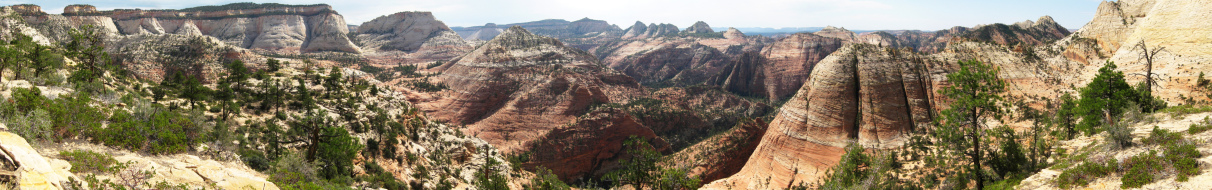
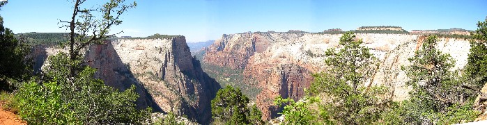
The south side of east Zion from just below the top of Progeny Peak, Zion, July 2008
|
|
|
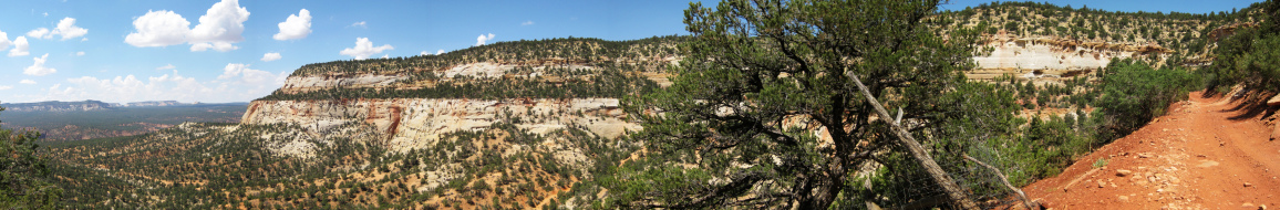
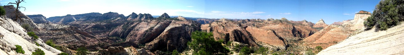
More Utah panos
|
|
|
 |
|
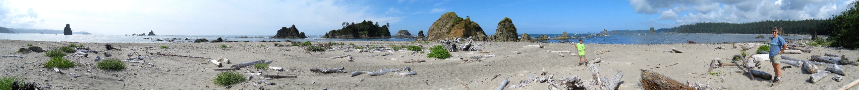
Toleak Point, August 2007
|
|
 |
|
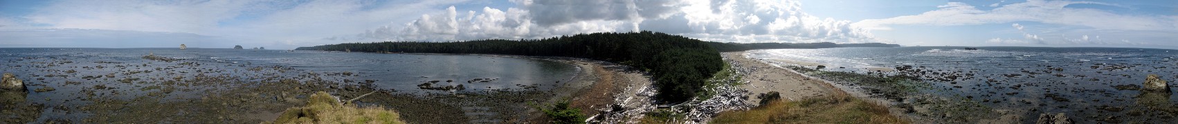
Sand Point, 360 degree view, August 2008
|
|
 |
|
Crying Lady Rock at Second Beach, extreme low tide, August 2008
|
|
 |
|
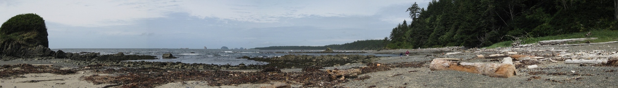
South of Sand Point, Near Yellow Banks, August 2008
|
|
 |
|
Scott Creek (far left and brown color in the ocean), Giants Graveyard, Teawhit Head (distant), Taylor Point, "Hidden" Beach, and Scott's Bluff, August 2008
|
|
 |
|
North of Hole in Wall (seen at left side of the bay), mid tide, August 2008. 360 degree view.
|
|
 |
|
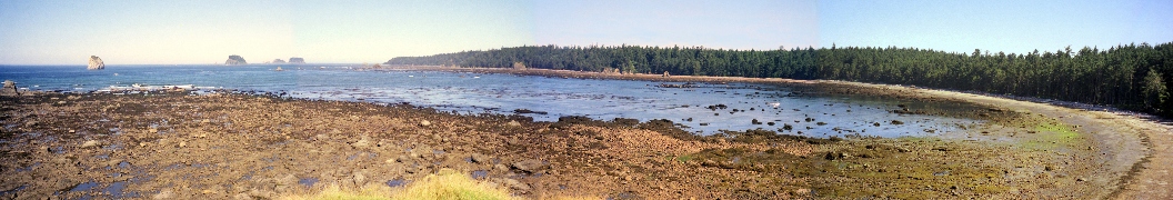
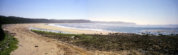
North from Sand Point at low tide, 1999
|
|
 |
|
Looking south toward Yellow Banks from Sand Point, 1999
|
|
|
|
 |
|
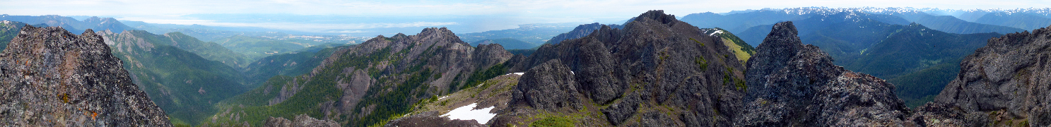
Summit of Mt. Angeles, August 2011
|
|
 |
|
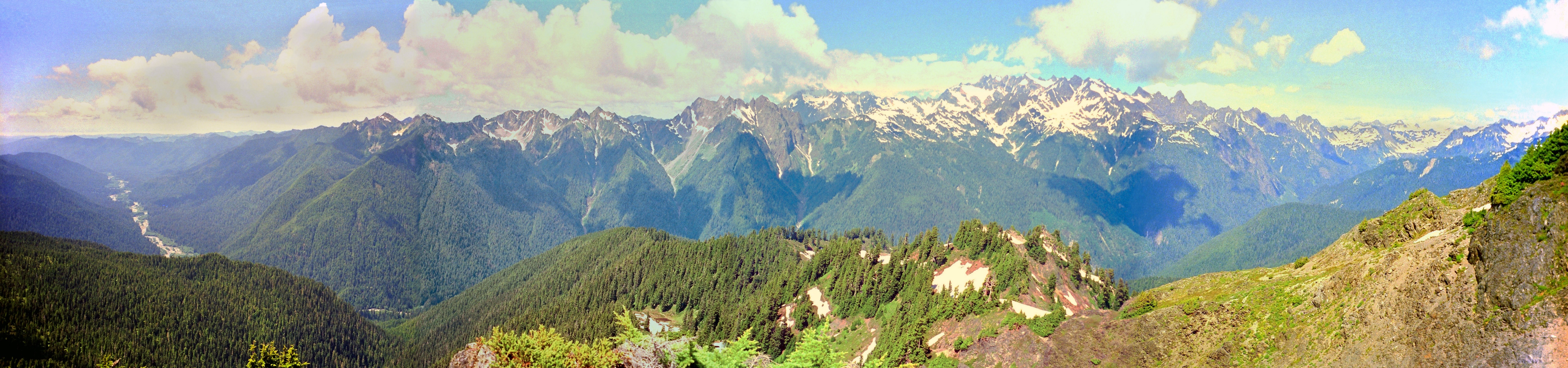
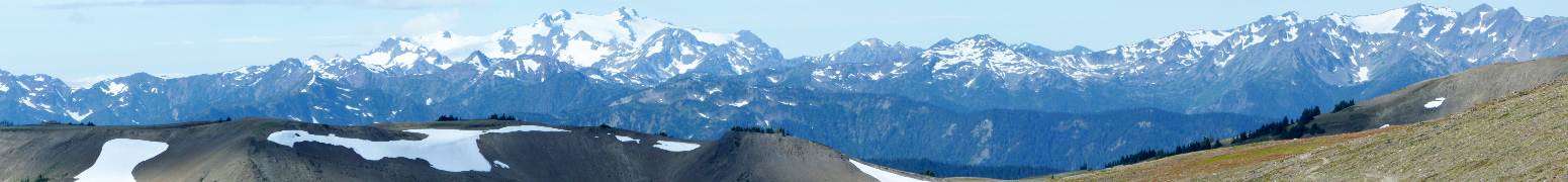
Mount Olympus and the Bailey Range from Mt. Angeles, August 2011
|
|
 |
|
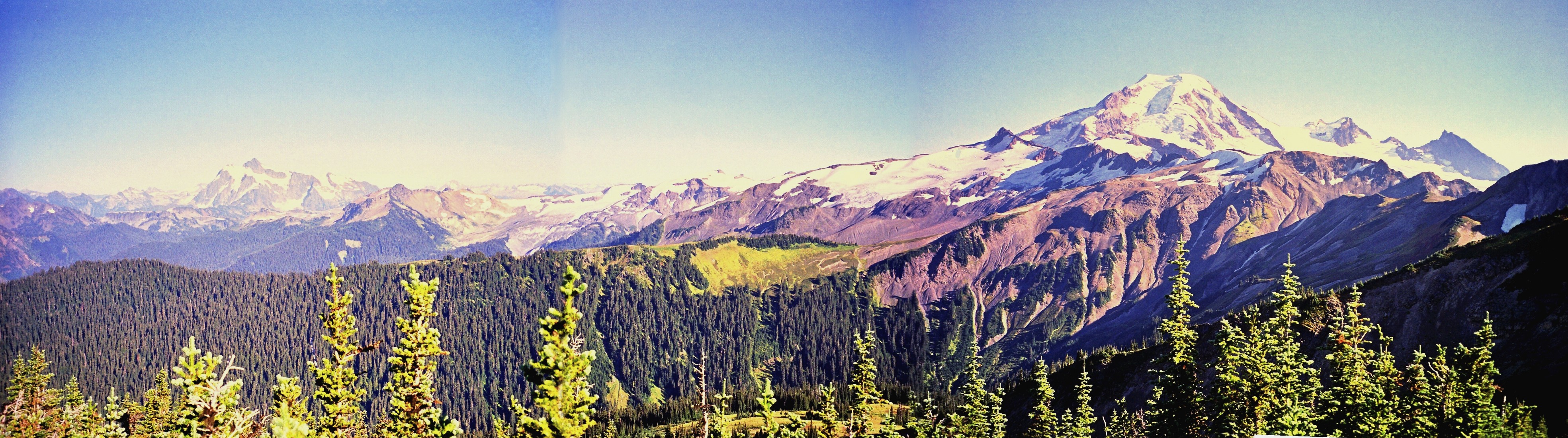
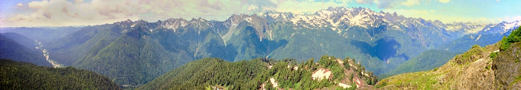
Mount Olympus and the Bailey Range from Elk Mountain, August 2010
|
|
 |
|
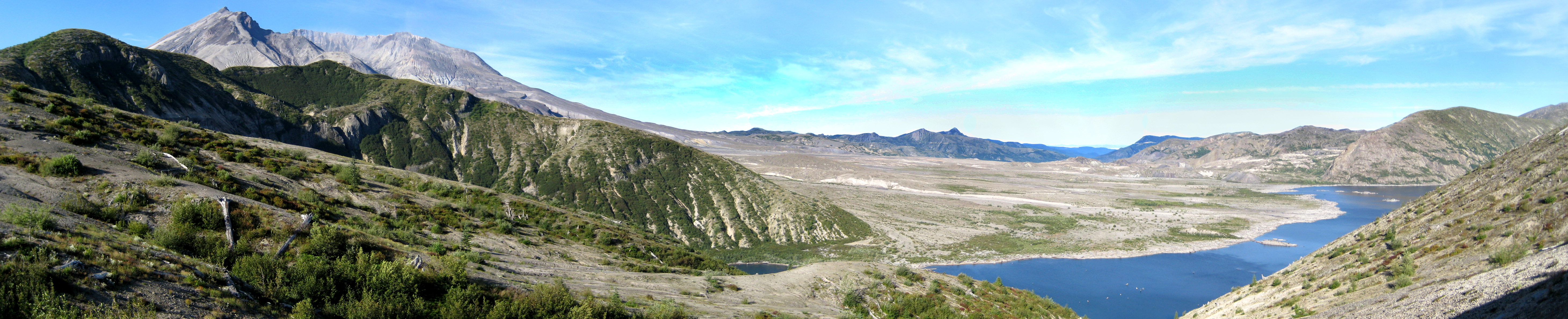
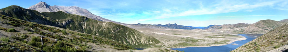
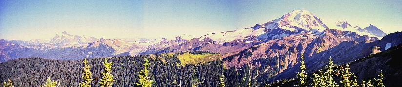
Mt. St. Helens and Spirit Lake from Windy Ridge road end, August 2007
|
|
 |
|
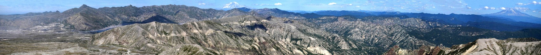
The Pumice Plain, Mt. Rainier, and Mt. Adams from near Windy Pass, Mount St. Helens, August, 2007. All the grey used to be forested before the blast, which was focused in the direction of view.
|
|
 |
|
Mt. Baker, August 1998
|
|
 |
|
Mt. Olympus and the Queets River from near Kimta Peak, August 1995
|
|
|
|
 |
|
360 degree view of the summit of Mt. Ethel, Park Range, August 1996
|
|
 |
|
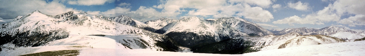
Independence Pass, June 1999
|
|
 |
|
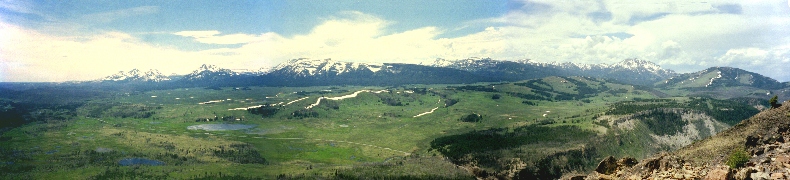
Lost Ranger Peak, Park Range, July 1997. Mt. Ethel on the far right, and the Mt. Zirkel wilderness on the left (all on the Continental Divide). North Park valley is visible in the center (east).
|
|
Wyoming
|
 |
|
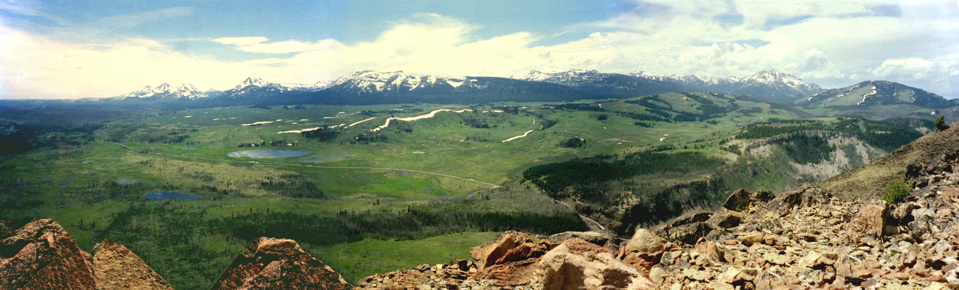
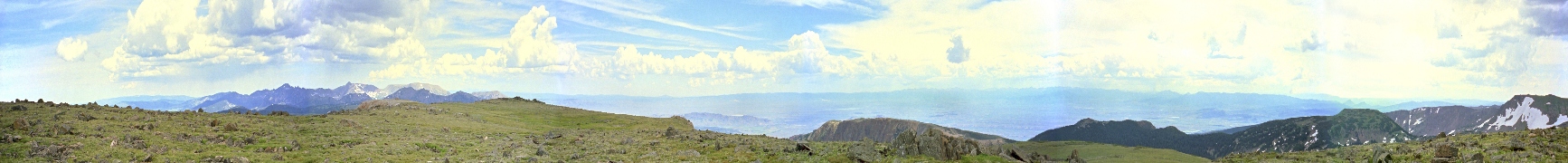
From Mt. Bunsen in Yellowstone, June 1997
|
|
|
|
 |
|
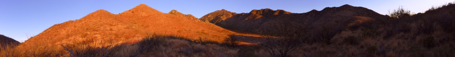
Santa Ritas, Tuscon, and Santa Catalinas, from Tanque Verde Ridge, December 2009
|
|
 |
|
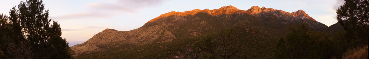
Mt. Wrightson and Madera Canyon at dusk, December 2009
|
|
 |
|
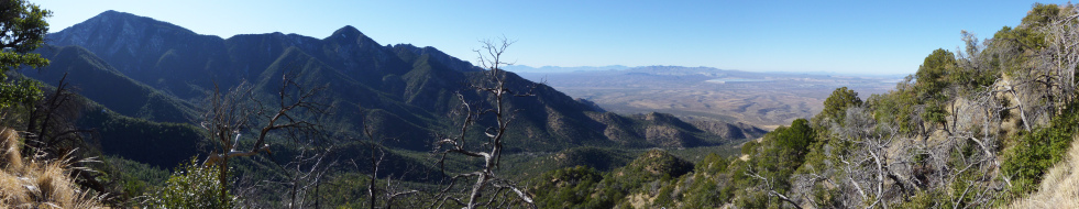
Santa Cruz valley from Elephant Head, January 2010, 360 degree view
|
|
 |
|
Grassland hills at dusk, January 2010
|
|
 |
|
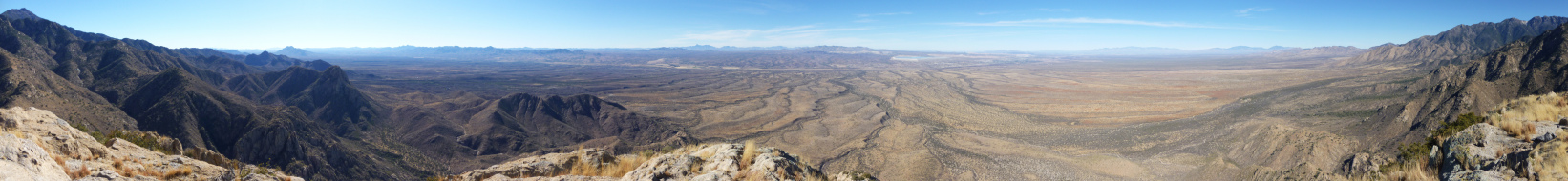
Southern Santa Rita mountains and view toward Mexico, December 2009
|
|
 |
|
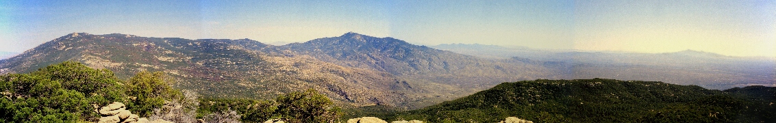
Mt. Hopkins, Madera Canyon, and the view west, January 2010
|
|
 |
|
Rincon Mountains from Tanque Verde Peak, with Santa Ritas to the south (right), March 1999
|
|
 |
|
View from Elephant Head, March 1997. The ridge on the far right comes down from the distant rocky ridge on the far left, near Mt. Wrightson, making just under 360 degrees of view.
|
|
 |
|
View from Josephine Peak, Santa Rita Mountains, March 1997. This panorama extends more than 360 degrees. The high point is Mt. Wrightson; to its left is Mt. Hopkins (observatory). Between is Josephine Saddle, and a view over it to the Pima Mine. Most of what is beyond Hopkins is in Mexico. The Rincons, east of Tucson, are distant on the far right (north), behind me to my right, and also on the far left.
|
|
 |
|
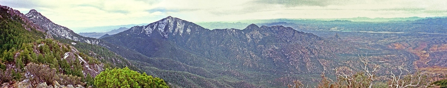
South from McCleary Peak over Madera Canyon, March 1997. Mt. Wrightson at far left, Mt. Hopkins with snow, and Elephant head at the right end of the ridge behind the canyon.
|
|
 |
|
North from McCleary Peak, March 1997. Right of center is brown Mt. Fagan, the north end of the Santa Rita Range. The Santa Catalinas are dark behind the street grid of Tucson, Rincons a bit nearer to the right.
|
|
Seashores
|
 |
|
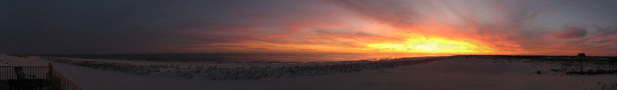
Sunset, Gulf Shores, Alabama, December 2008
|
|
 |
|
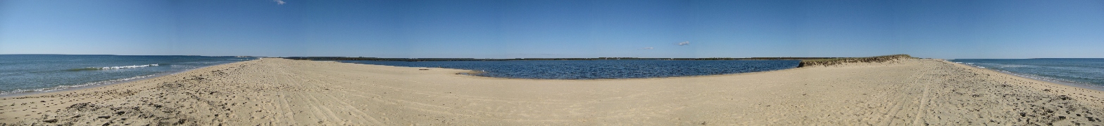
Long Point, Martha's Vineyard, Fall 2008
|
|
 |
|
Entrance to Mobile Bay from the east side, Dec. 2008
|
|
 |
|
Perdido Key, Florida, Dec. 2008
|
|